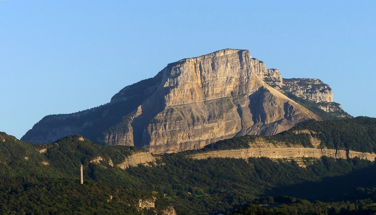
Mont Granier
A towering limestone cliff in the French Prealps, scarred by one of the largest historical rockslides in the Alps — a landscape frozen mid-collapse.
About this spectacle
Mont Granier is a dramatic limestone massif rising above the Chartreuse range in the French Prealps, most famous for the catastrophic 1248 rockslide that buried several villages beneath its face — one of the largest recorded historical landslides in the Alps. Visitors approach through forested valleys and open pasturelands, looking up at the sheer cliff faces and the vast rocky debris field — the Désert de Lans — that spreads across the valley floor. The summit offers sweeping panoramas over the Chartreuse plateau, the Belledonne range, and on clear days the distant peaks of Mont Blanc. The geological drama is immediate: crumbling limestone buttresses, deep fissures, and scree slopes tell a story of slow and violent collapse written across centuries. Hikers in season traverse marked trails through beech forests before emerging onto exposed limestone ridges where griffon vultures sometimes wheel overhead. The contrast of pastoral Alpine scenery with raw geological scarring makes this a site of quiet, absorbing power.
When to go
May — Oct, peak May — Sep
Getting there
Nearest airport: GNB. Nearest city: Chambéry.
Booking options
Goyova doesn't process bookings directly. When you tap "Plan this trip" in the app, you'll see options from our partner providers — accommodation, tours, transport — with affiliate links where applicable. See our affiliate disclosure for details.
More like this.
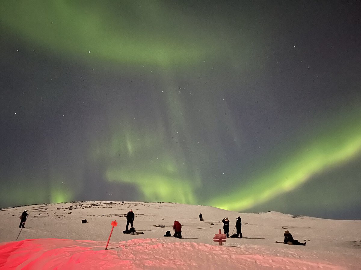 Returns Jan 2027
 Abisko Aurora Sky Station
Sweden
 Off-season
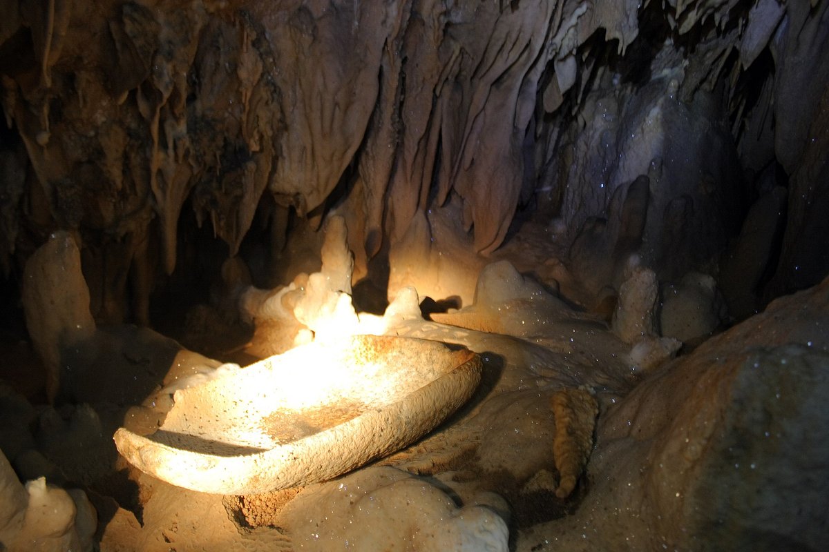
 Actun Tunichil Muknal — Cayo Belize
San Ignacio, Cayo District, BZ
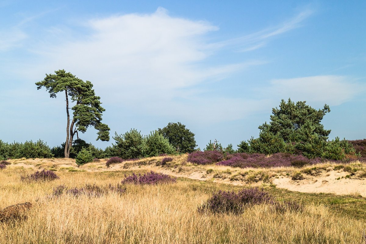 Peak season
 Aekingerzand
NL